|
January
1st - Shannon and I parked at Carver's Gap
on the Tennessee/North Carolina state line (taking
highway 143 from Roan Mountain). We had a
clear, sunny day with mild temperatures for this
time of year, but the winds at this high altitude
must have been up to 30+ mph gusts making it pretty
chilly.
Our
hike started on the Appalachian Trail (north),
immediately climbing up the west side of the
mountain on a newly constructed section of the trail
that was freshly graveled over a drainage matting
surface, obviously to accommodate a lot of hikers in
this popular destination to the Roan Mountain area.
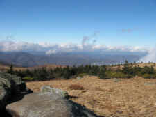
After a moderate climb
winding through a conifer forest and numerous
Rhododendrons, we summitted Round Bald (elevation -
5825 ft.). The views at this summit were
breathtaking in all directions. We looked
northeast into Virginia and it's highest peak Mt.
Rogers. Looking more northwest (towards
Johnson City and Elizabethton) were the mountains of
eastern Tennessee, and the Clinch Mountain range in
the distance. Easterly views showed us North
Carolina's Mt. Mitchell, the highest peak east of
the Mississippi River, and the Black Mountains.
Also easily visible were Grandfather Mountain and
Sugar Mountain.
(Click
all images for larger photos)
|
 |
 |
 |
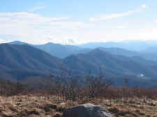
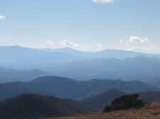
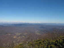
| Mountains
of North Carolina From Round Bald |
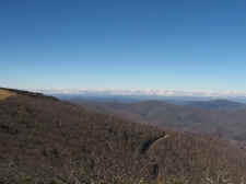
Highway
143 Leading to Carver's Gap |
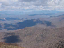
Shadows
of Clouds on the Mountains Below Us |
|
|
|
|
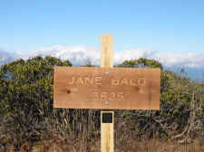
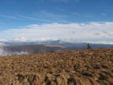
From
Round Bald the nice graveled trail ceased, and our
hike continued downhill through Engine Gap, where we
soon began the steep climb up to Jane Bald
(elevation - 5826 ft.). This peak lies halfway
between Round Bald and our destination Grassy Ridge.
It is again a treeless peak allowing wonderful views
in all directions. Near the summit there were
numerous rock outcroppings where Shannon and I
stopped for water, an apple, and to take the
following photos:
|
 |
 |
 |
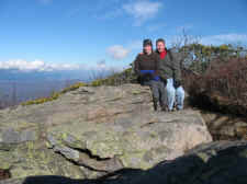
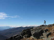
| Near
the Summit of Jane Bald |
I
Set the Camera on Auto for this Shot, and the Wind
Almost Blew it Off a Rock |
Summit
of Jane Bald |
|
|
|
|
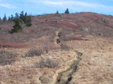
Following
our short break at Jane Bald we descended down a
ridge for approximately .5 mile where we left the
Appalachian Trail and began our final assent on
Grassy Ridge Bald... a 500 foot climb. The
farther we made our way up this trail the more it
became a small creek than a trail, making the climb
a little slower. But as we got near the top,
much of the trail was in dense Rhododendrons finally
giving us a break from the strong winds. We
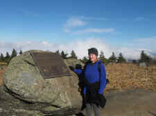
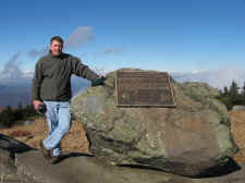
soon summitted Grassy Ridge (elevation - 6189 ft.)
where there is a memorial plaque dedicated to
Cornelious Rex Peake.
|
|
|
 |
 |
|
Leaving
the AT Going up Grassy Ridge |
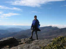
Shannon
at the Summit of Grassy Ridge |
She
Wouldn't Have Made it Without Expert Mountaineer
"Possum Fuller" Leading the Way |
|
|
|
|
The
views atop Grassy Ridge Bald were astonishing, and
this expansive bald (along with the extreme winds)
gave you the impression that you were above the tree
line.
|
|
|
 |
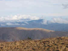 |
| Looking
North to Eastern Tennessee |
Grassy
Ridge With Grandfather Mountain in the Background |
Another
View of Grandfather and Sugar Mountains |
|
|
|
|
After
reaching the summit of Grassy Ridge Bald, Shannon
convinced me to go further down the ridge (another
.3 miles to the ridge's end) where numerous rock
outcroppings covered the side of the mountain.
This trail took us into dense Catawba Rhododendrons
which again gave us relief from the wind, and it
almost seemed as if you were in a cave of foliage
separated only by the trail. At some points we
would emerge up from this "cave" onto rock
outcroppings with stunning vistas. This was my
favorite spot of the entire trip, and I was so glad
we decided to hike that extra little bit to get to
this point. After reaching the end of the
ridge, we found a nice rock that was somewhat out of
the wind to have lunch.
|
|
|
 |
 |
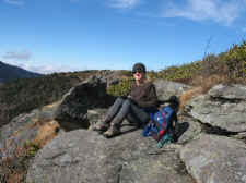
| Shannon
at the End of the Ridge; Mountains of N.C. Behind
Her |
Stopping
for Lunch |
Beautiful
Views Atop Grassy Ridge Bald |
|
|
|
|
We
took a few photos after lunch then decided it was
time to begin or trek back as the clouds were
starting to move in quickly. Our first
hike of 2007 on the Balds of Roan Highlands (which
turned about to be around 5.5 miles) gave us
undoubtedly some of the best views in the eastern
United States.
|
 |
 |
 |
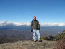
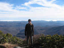
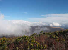
| Clouds
Coming In |
Bill
Looking at Roan High Knob With Clouds Rolling Over
Its 6286 Peak |
Shannon
With Roan Directly Behind Her, and Unaka Mountains
Near Erwin in the Distance |
|
|
|
|
|
|
|
One
Final Shot From Jane Bald |
|
|
|
|
|
Topo
Map of Grassy Balds of Roan Highlands |
|
|
HOME |
|


