|
PINNACLE NATURAL AREA PRESERVE
(Russell County, VA) |
| |
|
|
|
June 21st, 2009 -
I went on a great
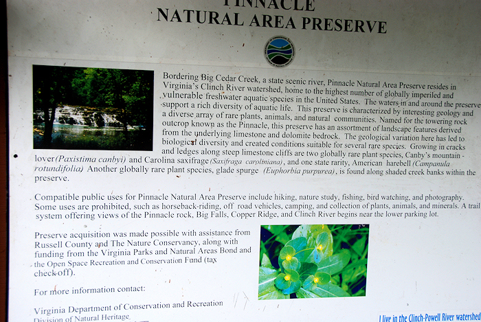
hike with my Dad on Father's Day to the Pinnacle Natural Area
Preserve in Russell County, Virginia. This is an area that
I visited frequently as a child, fishing and exploring with my
father and grandfather. Only, recently has this beautiful
place been protected by the State of Virginia due to rare
species and rare natural communities of mussels. It is now
considered State Park. We
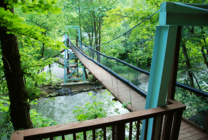
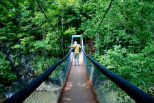
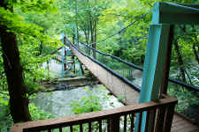
started our hike near the swinging bridge that has been
completely rebuilt in recent years. When I was boy we
would cross the old bridge that was so rickety it nearly scared
me death. The new bridge is quite an
improvement. |
| |
|
|
|
|
|
Dad
Crossing the Swinging Bridge |
|
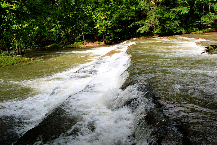
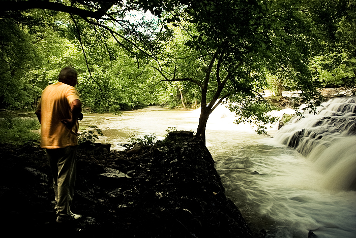
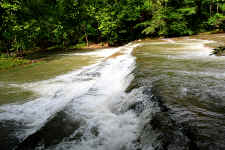
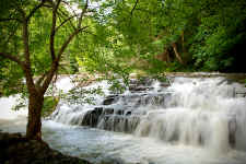
Small
Waterfall on Big Cedar Creek |
|
|
|
|
 |
|
 |
|
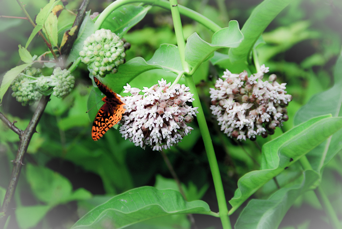
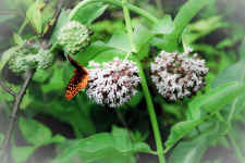
Butterfly |
|
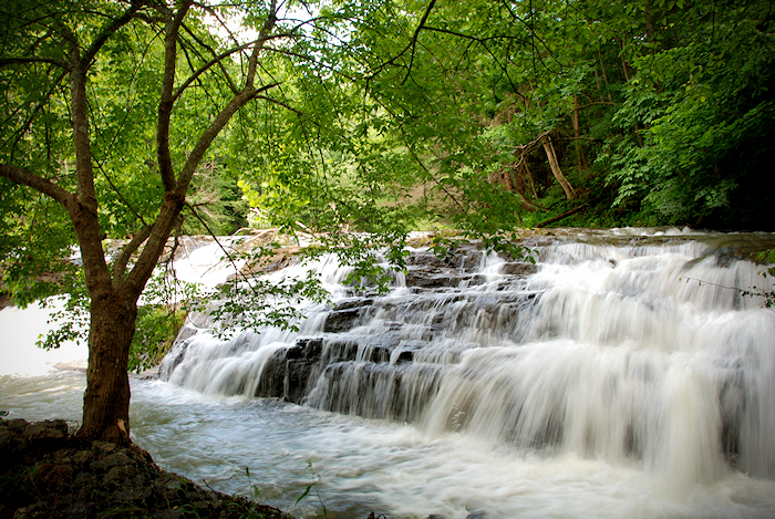
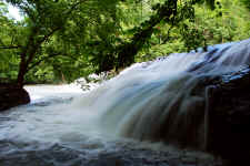
"Big
Falls" on Big Cedar Creek |
|
|
|
|
 |
|
 |
|
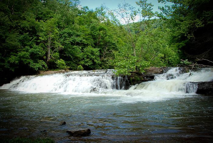
Another View of the
Falls |
|
Side
Angle |
| |
|
After crossing the
swinging bridge, Dad and I hiked down the forest road (which is
called the "Big Cedar Creek Trail") for one mile until
we reached the picnic/bathroom area. From here, we got
sidetracked for a couple of tenths of a mile as we following Big
Cedar to a small waterfall (seen above). We retraced our
steps and then found the "Clinch River Trail" where
followed it to "Big Falls"
This is a nice
waterfall as it extends across the entire stream... even wider
than the normal width of the stream. It's a hard one to
photograph though as it sits in full sun, and there are not many
good vantage points to photograph from. |
| |
|
|
 |
|
 |
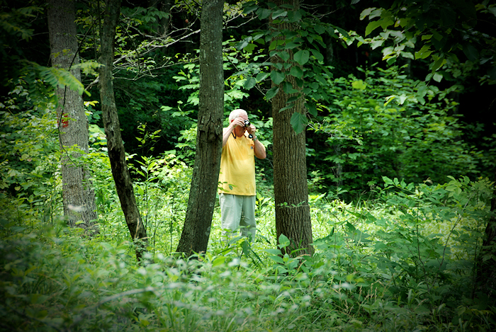
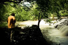
| Dad
at the Falls |
|
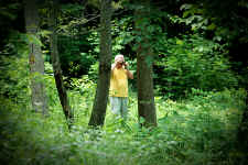
Taking
Photos |
| |
|
|
 |
|
 |
|
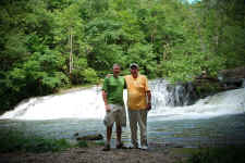
Me
and My Dad at the Falls -
Father's
Day 2009 |
|
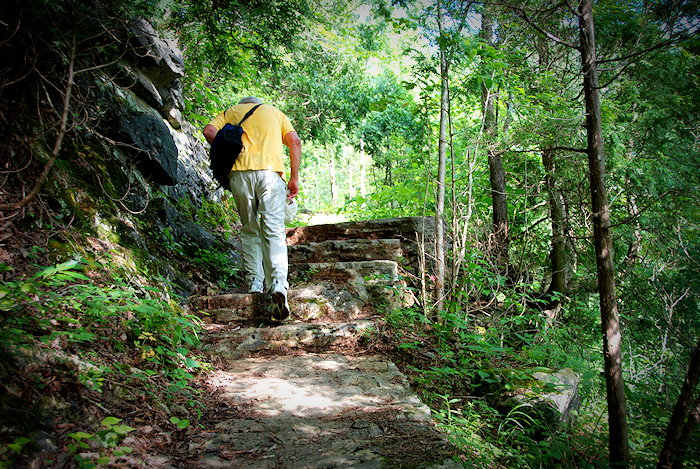
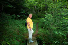
Dad
on the Trail to Pinnacle |
| |
|
|
 |
|
 |
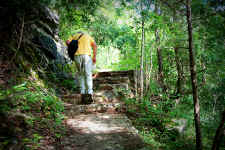
| Climbing
Steps |
|
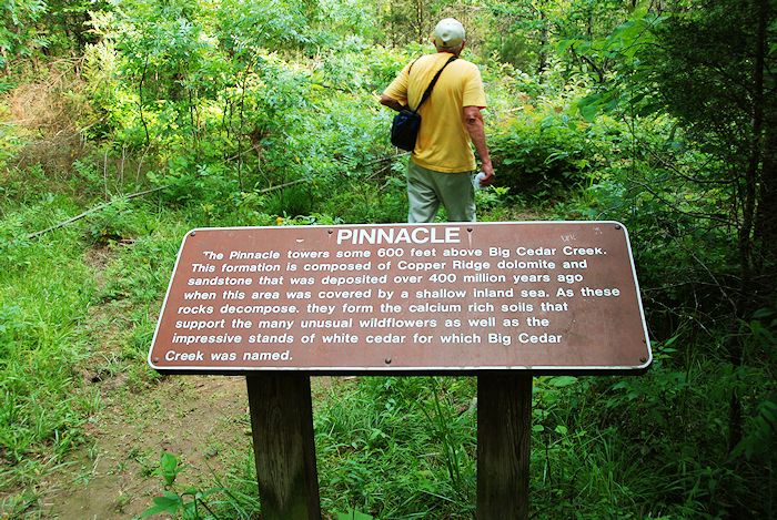
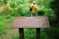
Sign Near Pinnacle
View |
| |
|
|
|
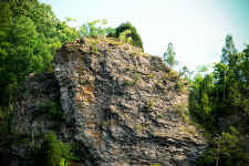
After the falls we kept going
on the Clinch River Trail to the junction of the Pinnacle View
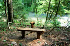
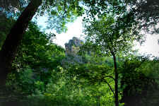
Loop trail, where we followed it until we reached "Pinnacle
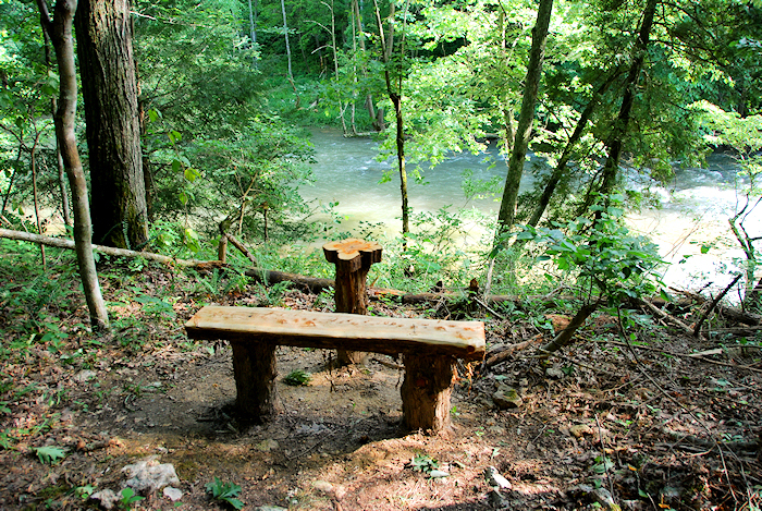
View". This was a nice spot with a bench that looked
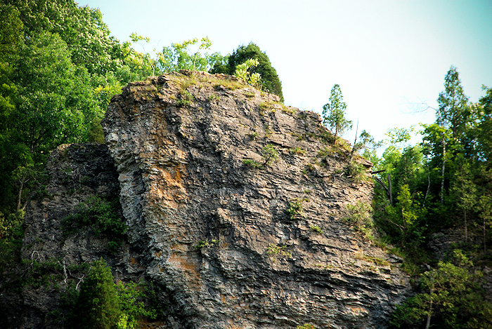
directly up to Pinnacle Rock through the trees. I
have climbed up to the summit of Pinnacle Rock when I was
younger, but would love to do it again soon.
Interestingly, I have an
ancestor (my great-great grandfather Taylor Litton of whom I and
many of relatives were named after) that was killed neared
Pinnacle. Here's
a copy of the obituary, which says he was killed by a
Grizzly. This must be a mistake as it must have been a
Black Bear in this area.
|
|
|
|
|
 |
|
 |
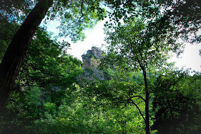
| View
of the 600' Pinnacle Rock |
|
Bench
Where We Stopped for a Rest |
| |
|
|
 |
|
 |
| Pinnacle
Rock Through the Trees |
|
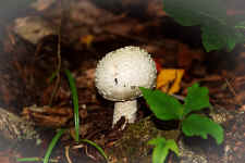
Mushroom |
| |
|
|
 |
|
 |
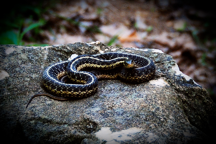
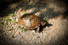
| Terrapin |
|
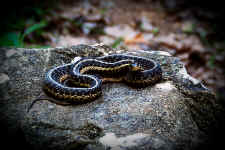
Snake |
| |
|
|
|
Following "Pinnacle
View", Dad and I worked our way back to the
car. We saw lots of wildflowers and wildlife along the way including
butterflies, terrapins, and a snake (that I almost sat down
on). Overall, this is just a fantastic hike... the
waterfall is really nice, the trails are well-maintained, and
the swinging bridge is a cool feature. I'll be returning
soon to check out the Copper Ridge Trail, along with hopefully
getting to the top of Pinnacle Rock again.
|
| |
|
|
 |
|
 |
| Another
View of the Rebuilt Swinging Bridge |
|
Sign Near the Trailhead |
| |
|
|
 |
|
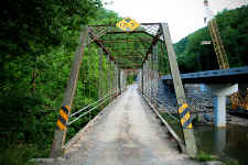
An
Old Steel Bridge on up the Road...
One
of the last of its Kind in the State of VA |
| |
|
|
|
Dad and I finished off our
great day by riding on up the road to check out this old steel bridge
crossing the Clinch River (seen above). It is one of the last
remaining steel bridges in the State, and as you can see it will be soon
replaced with a new modern bridge. |
| |
|
|
|
Total Miles
Hiked: 3.2 |
|
Hike
Rating -
Bill's
Overall Rating:
Distance:
3.2 miles (Probably around 3.0 round-trip directly to
"Pinnacle View"
Difficulty:
EASY
Type:
OUT & BACK Vista
Rating: Waterfall
Rating: H(1) + F(6) + V(3) + W(5)
+ G(2+4+7) = 28 Water
Crossings: NONE Scrambling/Climbing:
EASY Hazards:
slippery slopes, avoidable cliffs, open bridge Significance:
Natural Preserve, Rare Species, Wildflowers, Swinging Bridge,
Waterfall Recommendation:
Family/Beginner, Average Day-hike
Click
here for hike rating reference guide.
|
Copyright © 2007
All Right Reserved. All Images, Logos, and Photos are the
property of
HikingBill.com
or
Bill Fuller Photography |