.


SILL BRANCH FALLS & PINE RIDGE FALLS
     

January 26th, 2008 - I went out to the Clark's Creek area in Unicoi County (off of Highway 107 toward Greenville) to check out some waterfalls.  It was my first time in this area and I found it to be a very scenic place.  


I started my hike on Trail #115 (Sill Branch North), 
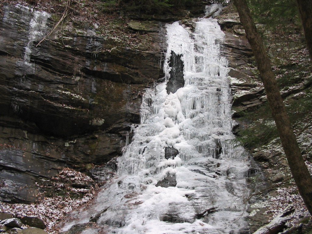
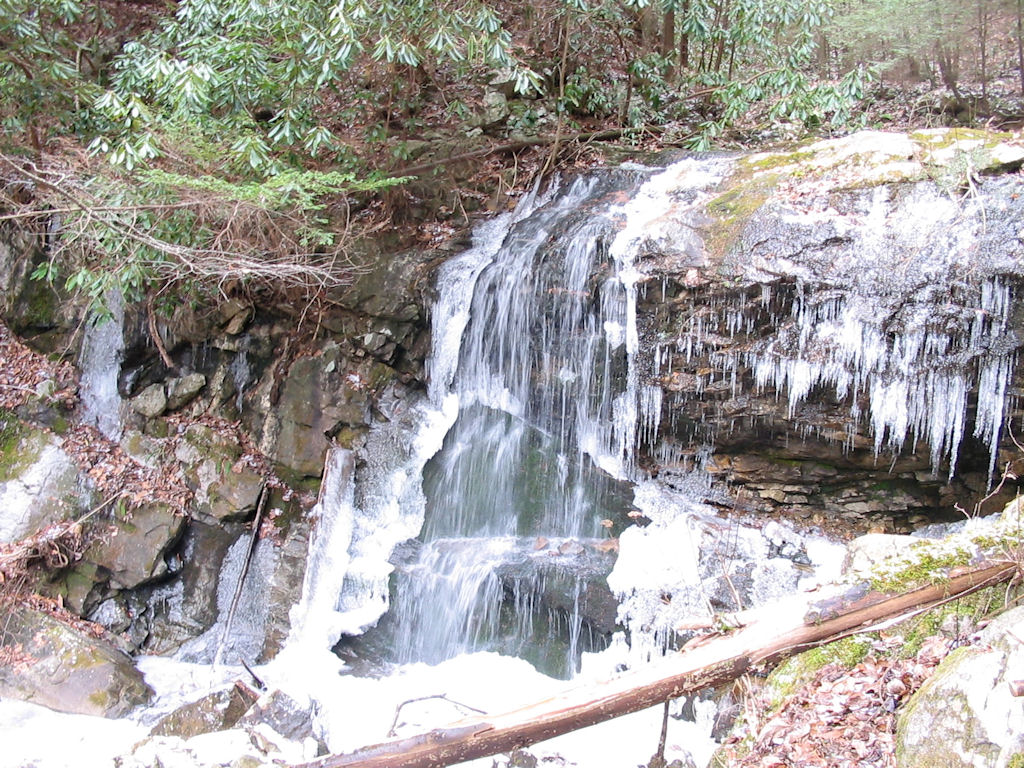
and after a half-mile trek I reached lower Sill Branch Falls, which was almost completely frozen.  This is a very nice 50' waterfall that I plan on returning to this spring with milder weather and hopefully more water flow.  Trail #115 is an easy and short hike, so I would recommend it for children.  There is also an upper Sill Branch Falls that is off-trail, so I hope to check that out later in the year as well. 


I took a few photos of the falls, then retraced my steps until I ran into the intersection of 
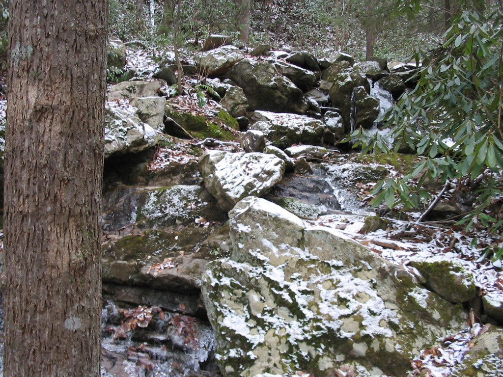
Trail #116 (Sill Branch South), of which I began to follow as it went up beside the South Fork of Sill Branch.  The first half mile or so was a very pleasant hike as it had a gradual incline that followed the small stream while crossing it six or seven times.


Frozen Sill Branch Falls

  Small Cascades on Sill Branch South
     

After about a half-mile on this trail, it turned and left the stream and began a steep climb up a steep ridgeline. My topo map lists this entire trail "moderate", but it's anything but that.  Maybe the first half mile is moderate, but this final half-mile mile was one of the toughest climbs I've had in a while as I ascended from approximately 2500' to 3300'.  Much of the trail was so steep that I was on my tiptoes a lot of the time (and I had to walk on the sides of my feet on the decent).   There was also a recent forest fire in this area that had devastated much of the land. 


Eventually I made it to an old road-bed, which marked the end of the designated trail, so I turned around and worked my way back down to the car.    


Recent Forest Fires on the Sill Branch South Trail   Views from the Long Arm Branch Trail
     

After getting back to my car I drove on up the dirt road for another two-tenths of a mile and found the Long Arm Branch Trail-head.    I followed this trail for approximately .4 miles until I had to ford the stream.  Immediately after the stream, I turned left, leaving Long Arm Branch, and I then followed an un-marked trail for only a short distance until I ran into Pine Ridge Falls. 


These falls were also very nice and located in a scenic area.  Once again, most of the falls were frozen, so I'd like to return during warmer weather.  This is another very short and easy hike that would be great for children.  


There's more trails and waterfalls in this area, so I'll be back for sure.

     
Pine Ridge Falls
     

Total Miles Hiked:  4.0 


Directions to the Clark's Creek area from Johnson City:  Take I-26 to the Erwin/Jonesborough exit (#37). At the end of the ramp turn right and take State Rt. 81/107 for 6.5 miles.  Stay on Rt. 107 by turning left and continue for 5 more miles. Turn left onto Clark's Creek Road and drive 3.1 miles into the Cherokee National Forest to a parking area on the left. A sign will indicate the trailhead for Sill Branch Falls.  Travel another two tenths on up the road for Pine Ridge Falls.

  HOME  
  TRAIL LOGS  
  THE A.T.  
  SUMMITS  
  WATERFALLS  
  TRAIL SYSTEMS  
  BIOGRAPHY  
  MY GEAR  
  GOALS  
  CURRENT PROJECTS  
  OTHER ADVENTURES  
  OTHER INTERESTS  
  DOWNLOADS  
  RESOURCES  
  CONTACT BILL