| LITTLE
STONEY CREEK TRAIL - Dungannon, VA |
| |
|
|
|
March
2nd, 2008 -
It's early in the year, but I would guess that this hike will go
down as one of my favorites for all of 2008. We had a
warm, sunny day for early March, and the whole family came along
to share this trip with me... not to mention, this was one of
the most scenic and beautiful trails that I've ever hiked. |
| |
|
|
|
|
|
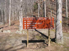
Sign
at Little Stoney Creek Trailhead |
|
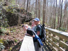
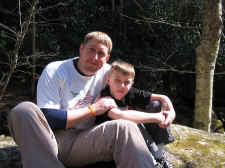
Cam,
Shannon, and Taylor at One of the Many Bridges |
| |
|
|
 |
|
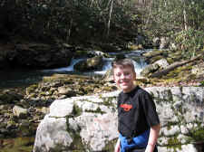 |
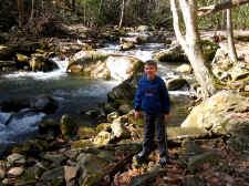
| Cam
Near the Beginning of the Hike |
|
Campbell
Again |
| |
|
|
|
The Little Stoney Creek Trail is
just outside of Dungannon, Virginia off of Highway VA72 at the
Hanging Rock Recreation Area (Jefferson National Forest). When we arrived at the park,
the main gate was closed so this added another 2 tenths of a
mile hike for us to get to the main trailhead.
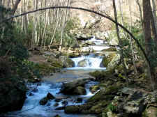
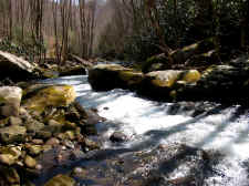
The trail followed directly
alongside the stream for the entire hike, and the scenery was
tremendous. Cascades and small waterfalls were everywhere,
while bridge crossings and rock ledges offered beautiful views.
The trail was also on an old railroad grade for much of the
hike, so there wasn't a lot of strenuous climbs. There
were a few minor rock scrambles that Cam really enjoyed, and the
trail also had very large bridges that crossed the stream on
numerous occasions, so there was no worry of getting wet,
however we did have to navigate one small creek crossing about
halfway up the hike (at the waterfall seen in the photo below). |
| |
|
|
 |
|
 |
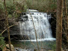
| Numerous
Cascades and Small Waterfalls on the Trail |
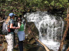
|
Shannon
and Taylor at One of the Smaller Falls |
| |
|
|
 |
|
 |
| More
at a Smaller Waterfall |
|
Bill
and Campbell Stop for a Snack and a Break |
| |
|
|
|
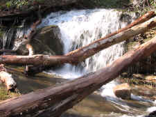
I would guess that there were ten
or more waterfalls in the 4-10 foot range, and even larger falls
if you wanted to go off trail to explore the subsidiary streams.
We also had nice views looking up at the "Hanging Rock" cliffs.
Taylor and I both took a bunch of photos.
|
| |
|
|
 |
|
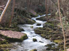 |
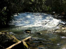
| Little
Stoney Creek |
|
More... |
| |
|
|
 |
|
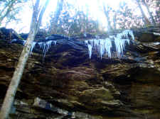 |
| One
of Taylor's Photos of a Pretty Cascade |
|
Tay's
"Icicle" Photo |
| |
|
|
|
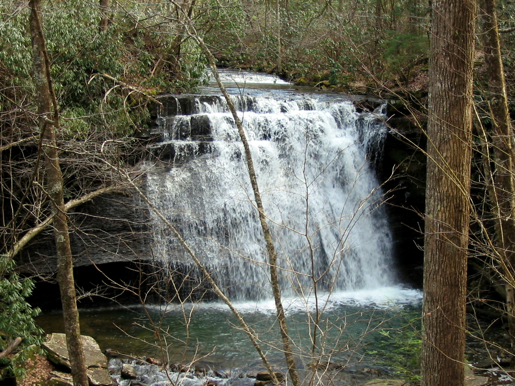
After about 2.5 miles of hiking we
came across the first of the three main waterfalls... the Lower
Stoney Creek Falls. This is about a 35 foot drop waterfall
that's very wide and scenic. We were also fortunate that
there was plenty of water flow on the day of our visit.
There's a viewing deck constructed in this area where we stopped
to take some photos. This was my favorite of all the
falls. |
| |
|
|
 |
|
 |
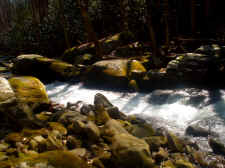
| Large
~10' Drop Cascade |
|
The First of the Large Waterfalls... Lower Stoney Creek Falls |
| |
|
|
 |
|
 |
| Cam
on the Viewing Deck at the Lower Falls |
|
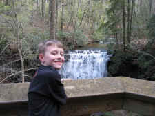
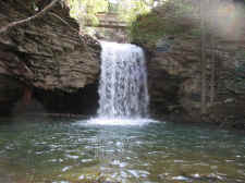
Upper
Stoney Creek Falls |
| |
|
|
|
After the Lower Falls we
hiked on up the trail where we went on by the Middle Falls. This
one was a tough climb down into the ravine to take good photos, so we
bypassed it for another time. We then continued our hike to the
Upper Stoney Creek Falls. This is ~30' waterfall that has a large
plunge pool, and a bridge that actually crosses over the top of the
falls. We
took the man-made rock steps down to the base and took more photos
before we turned around to hike back out. |
| |
|
|
 |
|
 |
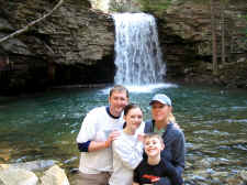
| Family
Photo at Upper Stoney Creek Falls |
|
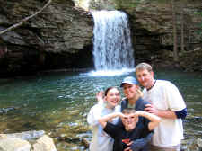
Silly
Faces at the Upper Falls |
| |
|
|
|
When we arrived at the car we
had hiked 5.6 miles. My GPS showed that we had ascended approximately
800 feet in elevation from the car to the Upper Falls.
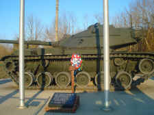
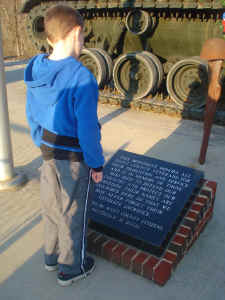
On the drive home we stopped
at the Scott County Veterans Memorial (on highway VA72), where there's a large tank along with
plaques of all the names of Scott County men and women who have died
defending our Country. After that, we finished our great day by
stopping off at El Matador for dinner. |
| |
|
|
 |
|
 |
| Scott
County Veterans Memorial Off of Highway VA72 |
|
Bill
and Cam at the Memorial |
| |
|
|
 |
|
 |
| Shannon
in Her New "Life is Good" Hat |
|
Campbell
Reading the Plaque at the Memorial |
|
Total
Miles Hiked: 5.6 |
|
|
|
Directions:
From Johnson City take I-26 toward Kingsport. Merge onto
Highway 23 (crossing into Virginia). In Gate City, turn
right onto Kane Street, and then take another right onto Jones
Street. Follow Jones St. to the stop sign and take a right
on highway VA71. Follow VA71 for approximately 1 mile, and
then turn left onto highway VA72. Follow highway VA72 for
approximately 21 miles. Shortly after going through the
town of Dungannon, you'll see the Hanging Rock Recreational Area
on your left. If the gate is open you can drive all the to
the back of the park where the trailhead is located.
|