| MARGARETTE
FALLS & BAILEY FALLS |
| |
|
|
|
March
30th, 2008 - Margarette
Falls and Bailey Falls are two gems located in Greene County,
Tennessee. Both can be found on the same stream (the West
Fork of Dry Creek), however one is very easy to view while the
other is very tough... The
hike begins on a graveled road that leads to a nice trail
ascending alongside the stream. (Note: See more
detailed directions below as I found the trail not very well
marked, and the only sign was at the parking area.) The
sign called the trail to Margarette Falls something like
"very difficult" or "extreme", but don't let
that scare you... It's a very moderate 1.2 mile hike with
around 500 feet of elevation gain. I would even recommend
it for small children with the only difficulty being a couple of
stream crossings that could get shoes
wet. The
whole area is extremely scenic with many cascades, numerous
boulders and rocks, high cliffs, and three smaller waterfalls
(~10') on the way up the
trail. |
| |
|
|
|

|
|
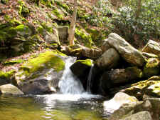
Numerous
Cascades |
|
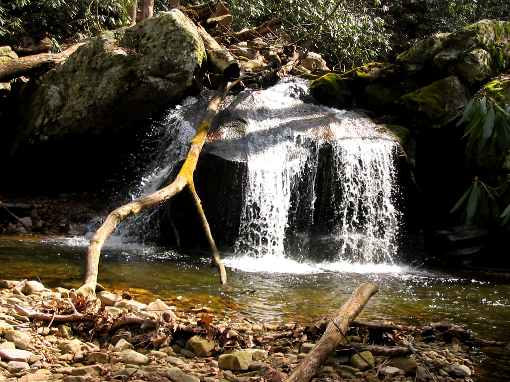
One
of Three Smaller Waterfalls on the Trail Up to Margarette Falls |
| |
|
|
 |
|
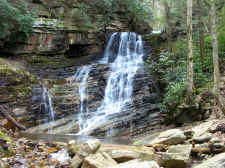 |
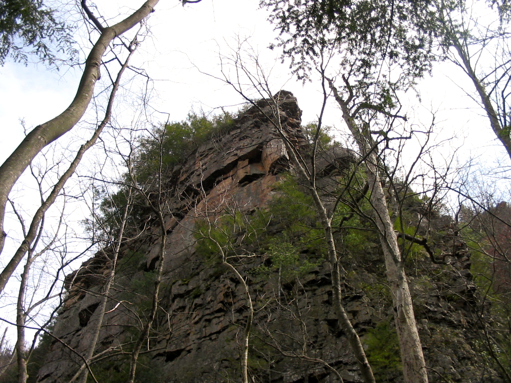
| Sheer
Cliffs Overhanging the Stream |
|
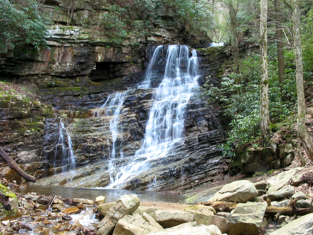
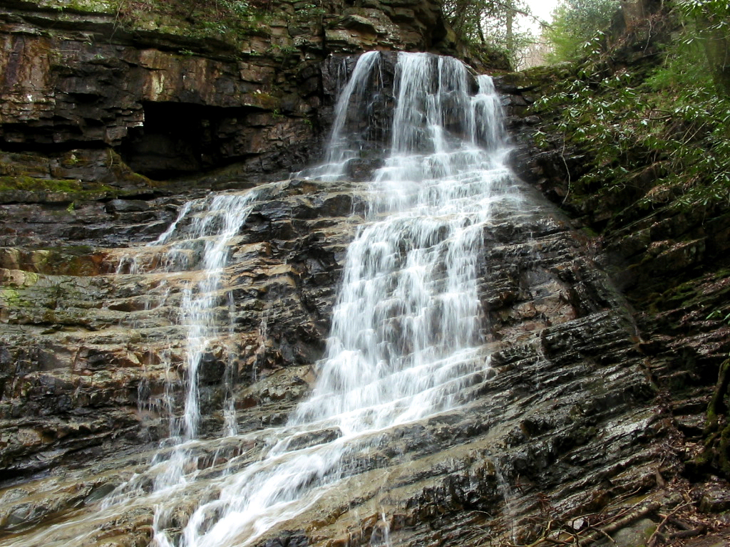
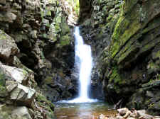
60'
Margarette Falls |
| |
|
|
|
Margarette
Falls is a very pretty ~60' cascading waterfall. It would
normally be a great one to photograph, but the high sunlight
didn't give me very good photo opportunities today. I ate
some lunch and did my best with the camera, then I decided to head
on upstream to find Bailey Falls. |
| |
|
|
 |
|
 |
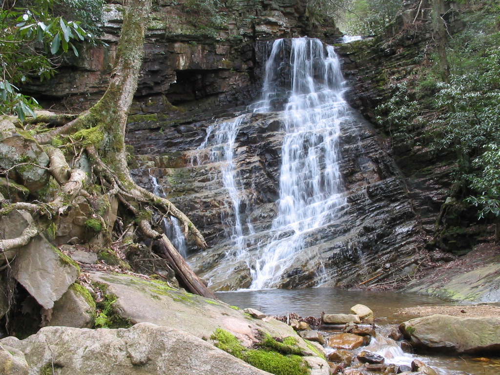
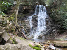
| Another
View |
|
Up
Close |
| |
|
|
|
I
first had to climb the steep embankment to the right of the
Margarette Falls to get to the crest. This was not too tough
as there was a decent trail leading the way, however once I
started heading on upstream the trail ceased. This was
actually one of the toughest bushwhacks I've encountered lately,
and I wouldn't recommend trying it alone, or if you don't want to
get really wet and muddy. In many places the sidewalls of
the ravine were so steep that I simply had to walk up the middle
of the stream. In other places I had to scramble over large
rocks and ledges, or ford the stream across tricky cascades.
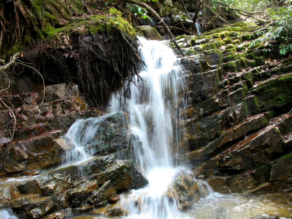
I also passed another small 10' waterfall (I think named Glen
Falls). The entire bushwhack was tough and slow going.
But after what I think was about .3 miles upstream from Margarette
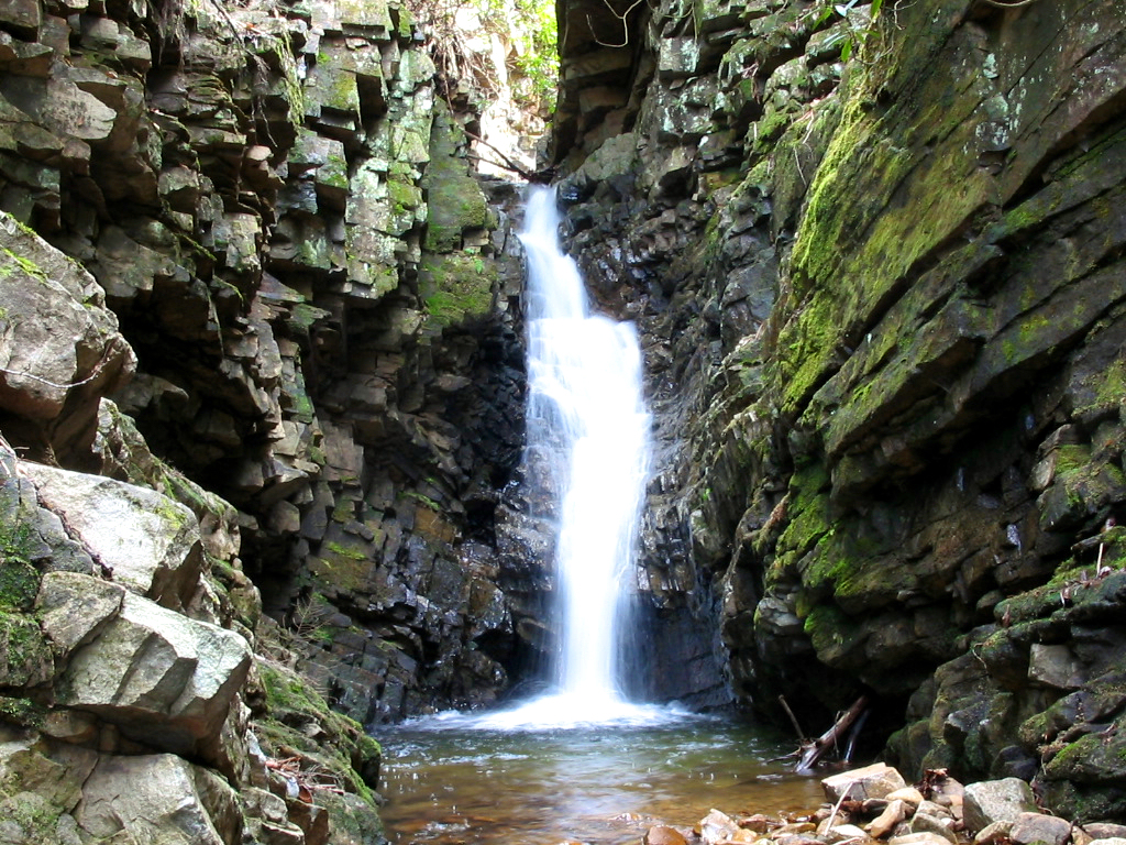
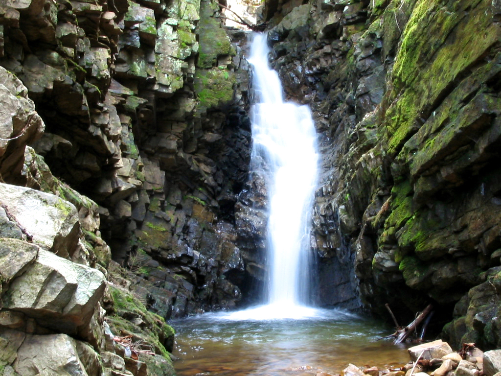
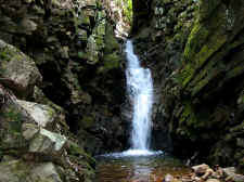
Falls, I found Bailey Falls... and it was worth it. The
falls set deep in an extremely narrow ravine. It almost felt
as if being in the middle of a cave as the sides of the ravine
were beyond vertical and probably 50+ feet high. The
waterfall itself is two-tiered with what I would think would be
around 40' of overall drop. I stood in the middle of the
stream since there was no where else to stand, and I took the
photos seen below. |
| |
|
|
 |
|
 |
| Glen
Falls (name?) Small 10' Waterfall on the Way to Bailey Falls |
|
Very
Scenic Bailey Falls |
| |
|
|
 |
|
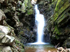 |
| Two-tiered,
Approximately 40' |
|
Located
in a Very Deep & Narrow Ravine |
| |
|
|
|
I
carefully retraced my steps back to Margarette Falls, and then
back down the trail to the Jeep for a round-trip of 3.1 miles, and
700 feet in elevation gain.
Total
Miles Hiked: 3.1
Getting There:
Driving
(this is probably not the fastest way, but it's the way I went) -
From Johnson City, take I-26 to the Erwin/Jonesborough exit (#37).
At the end of the ramp turn right and take State Rt. 81/107 for
6.5 miles. Stay on Rt. 107 by turning left and continue
for 14.8 miles. Turn left onto 351 South and drive 0.7 miles
where you will take a left on Middle Creek Road. Drive 3.5 miles
on Middle Creek Road until you reach a stop sign where you will
take a right onto Greystone Road. Follow Greystone for 2.0
miles, and take a left onto Shelton Mission Road where you will
follow it for another 2.0 miles. You will see a sign for the
trails, and then the parking area will be immediately on your
left. Trails
(there were no signs at trail junctions and very few blazes, so
please read carefully) - From the parking area you will see a road
(blocked off) and the only sign designating the trails. It's
private property on either side of this road, but it's fine to
take it. Walk up this road for approximately .5 mile
until it dead ends. This is the confusing area... You will
see two trails here... take the one on your right (at the two
large boulders). After approximately 50 yards this trail
will split again... take the one to the left. This is the
trail to Margarette Falls, which will be reached in another .7
mile. To get to Bailey Falls, climb the steep hill to the
right of Margarette Falls and keep going upstream (off trail) for
another .3 mile. |
|
|
HOME |
|